Slow Earthquakes in the Pacific Northwest
Installation of Shelton Tiltmeter
We completed installation of the first biaixal tiltmeter near Olympia at the Shelton airport. Since it is difficult to
excavate trenches deeper than 2.5 m, the long baseline tiltmeter must follow topogrpahic contours. Ideally, the
ends of the tiltmeter will be in a region that is well drained although we are constructing sensor systems that can operate
submerged for extended periods to mitigate for large annual rainfall in the Pacific Northwest.
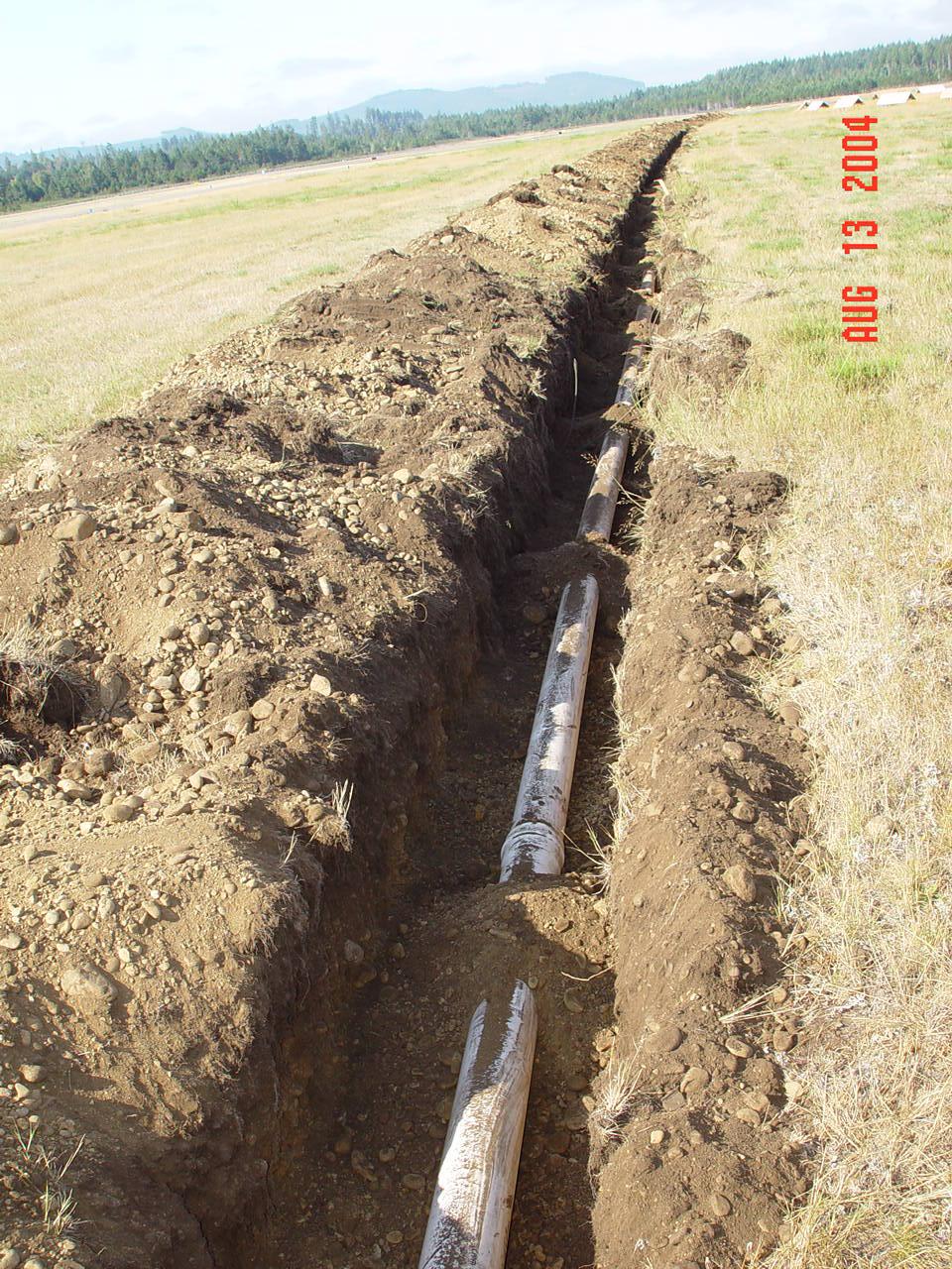
Pipe in Open Trench |
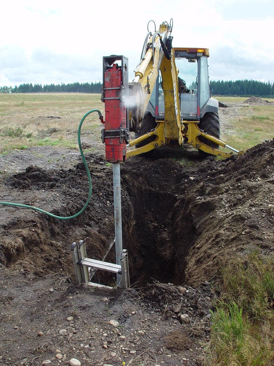
Driving Pier Monument |
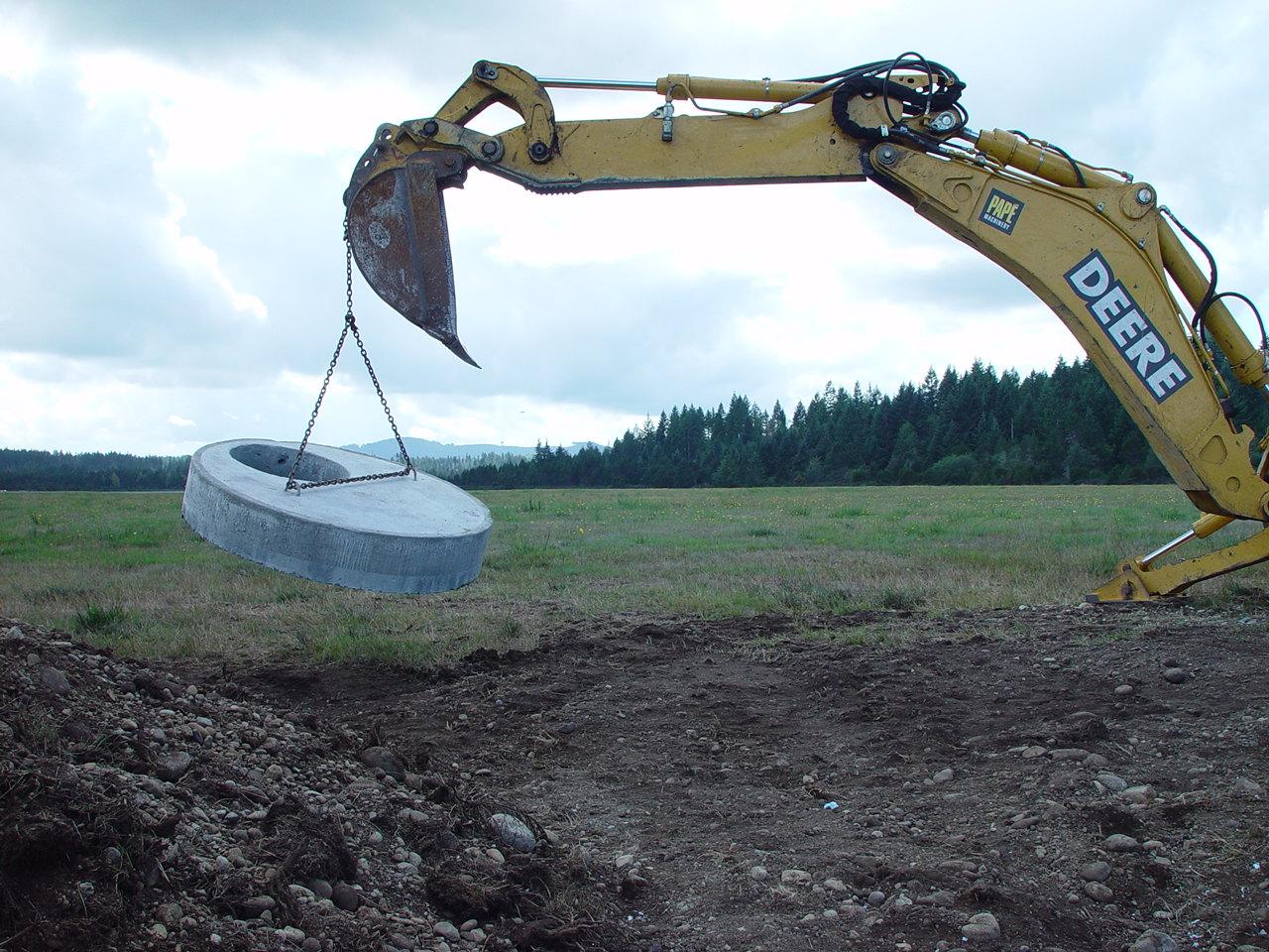
Setting Cover Lid |
The tiltmeter consists of two arms approximaely at right angles, in an L-shape plan view. The sensors are placed ~2 m underground and operate in three vaults accessed via 2' diameter concrete manhole lids. Cellular frequency transmission of data signal from each vault are transmitted to an AC data-logging computer stored inside. Data are then uploaded to CWU once daily.
Data stored in the computer are accessed via cell-phone through the internet. Power to the tiltmeter comes through an AC hookup (120V at 0.2 Amp is equivalent to a 25W light bulb).
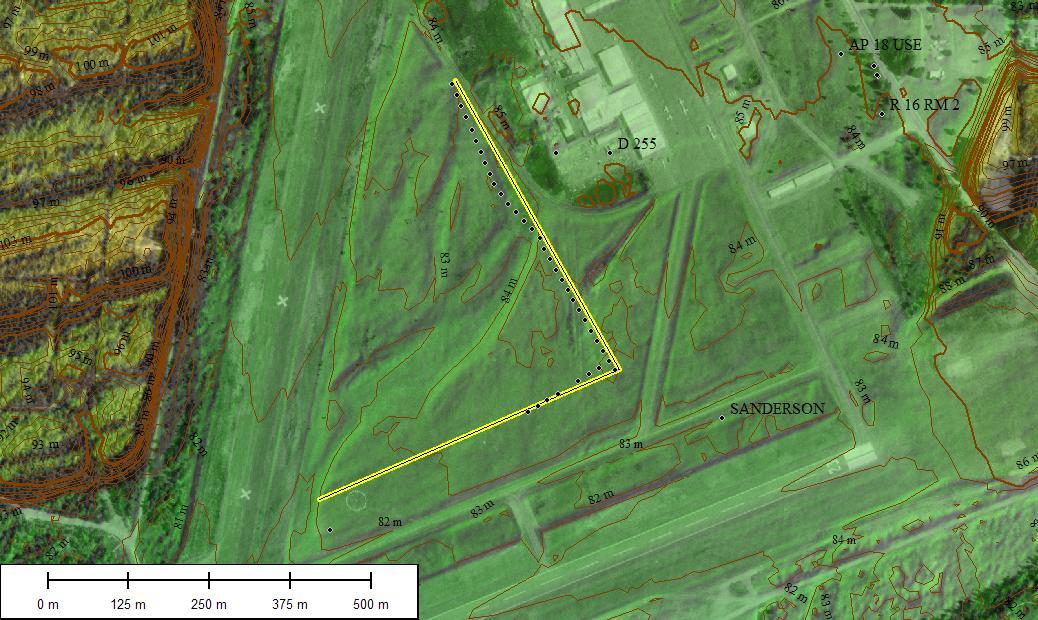
Map View of Pipe Location
Data are transmitted to a nearby computer via radio links every few seconds; the computer forwards data to analysis centers in Ellensburg, Washington and Boulder, Colorado. Three of these tiltmeters have now been installed in the Puget Sound region monitoring earthquake activity tens of miles underground. Data from the tiltmeters will help understand how increments in stress eventually lead to large earthquakes.
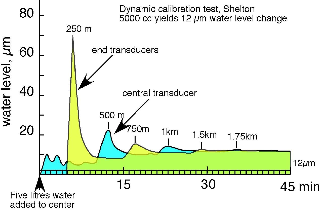
E-W Arm Calibration Test. |
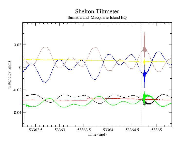
Elevation Data During the Sumatra EQ |